Video: Messages from the Marsh, Parts 1-3, 2021
Audio: A Rumble Inside, 2022
Maps: Atlas of Trouble, maps drawn with ink, watercolor, charcoal, graphite, on paper and vellum, 2022
The Messages from the Marsh project is developed via site-specific research, video documentation, and in-person engagement. Videos shown reflect on immersion of spaces inhabited, spaces transformed, and spaces potentially lost. The water’s skin, the separation of the realms of water and air, are explored through underwater and over water imaging. Each piece works in relationship with each other to suggest a fuller, interconnected and dynamic rhythm with resonant impact across their spaces. This work focuses on coastal marsh locations on the USA east coast, areas that are projected to be lost under water by 2050 through combinations of sea level rise, tides, and storm surge. I’ll continue to video above and within the marsh water bodies, and also create topographical maps of the marshes. The maps are marking a moment in time before the potential loss of these areas to ocean reclamation and salt marsh ecosystem collapse. I’ll continue to research the impact of coastal marsh loss on the ecosystem and probable species extinction, and efforts in preservation and management. Coastal marsh areas considered for the continued project, with travel permitting: Coastal marsh areas considered for the continued project, with travel permitting:
● Scituate, Conservation Park and Rivermoor Habitat Park, Norris Reservation, Bound Brook Pond, Marshfield English Salt Marsh, Duxbury, North & South Rivers, New Bedford
● Ipswich Salt Marsh, Great Marsh Areas of Ipswich and Essex, Plum Island Reserve, Rough Meadows Wildlife Sanctuary, Parker River National Wildlife Refuge, Salisbury
● Boston Harbor Islands, Seaport, Nahant, Revere, Winthrop, E. Boston, Chelsea, Dorchester, Quincy, Nantasket, Hull
● Truro, Pamet & Salt Marsh, Falmouth, Wequoit Bay Area of Critical Concern, Sandwich, Sandy Neck Beach Great Marshes
● Rachel Carson National Wildlife Refuge, Ogunquit, Wells National Estuarine Research Reserve, ME
● New York/Lower Manhattan, Long Island South Bay
● Delaware, Black Water National Refuge
● NC Outer Banks, Alligator River Reserve, Currituck Outer Banks, Shackleford Banks, Rachel Carson Reserve on Carrot Island Crystal Coast, Cedar Island National Wildlife Refuge
● Savannah, Savannah National Wildlife Refuge, Charleston
● Miami, Everglades National Park, Florida Keys, Sarasota
● New Orleans, Maurepas Swamp Wildlife Mgmt. Area, Bayou Sauvage National Wildlife Refuge
● Houston, Anahuac National Wildlife Refuge and Brazoria National Wildlife Refuge
Special thanks to Kenneth Hinegardner
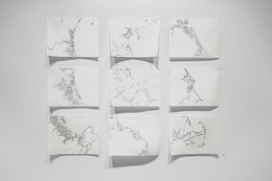
Massachusetts (USA) coastal areas threatened by sea level rise and coastal flooding. Land projected to be below annual flood level in 2050.
Photo: Will Howcroft Photography
Leave a Reply